Cycling & mountain biking
Bike trails in Terre Haute: paved routes & mountain biking
Compare the National Road Heritage Trail, Griffin Bike Park and Wabashiki before choosing a bike ride near Terre Haute, Indiana.
By Bell Tower Digital · Updated Oct 10, 2026 · Sources reviewed Oct 10, 2026
.jpg)
Compare at a glance
These are different riding environments. Choose by surface, route rules and experience; a published trail length is not a suggested ride distance for everyone.
National Road Heritage Trail
A paved corridor through Terre Haute
- Route
- The city's 2026 bike and pedestrian plan describes a 6.5-mile corridor.
- Surface
- The plan describes asphalt with rail-trail, off-street and sidewalk sections.
Choose your start, turnaround point and crossings before leaving; an end-to-end ride also needs a return plan.
Sources: Terre Haute: 2026 Bike & Pedestrian Plan, existing National Road Heritage Trail (page 30)
Griffin Bike Park
A dedicated mountain-bike destination
- Equipment
- The operator requires a helmet with its chin strap fastened.
- Access
- Dawn to dusk, weather permitting; check the operator's condition alerts.
Start with the official trail map and choose terrain that matches your riding experience.
Sources: Griffin Bike Park: hours, helmets and route rules · Vigo County: official Griffin Bike Park map (PDF)
Wabashiki Fish & Wildlife Area
A designated route through a wildlife area
- Route
- DNR allows bikes on the Dewey Point–Wabashiki trail.
- Limits
- No off-road riding; open paved and gravel vehicle roads also permit cycling.
Stay on the permitted route and check seasonal access restrictions.
Sources: Indiana DNR: Wabashiki cycling permissions and seasonal access
Match the route to the ride you want
For a ride on pavement, start by comparing the city corridor. For purpose-built mountain biking, start with Griffin. For a ride within a wildlife area, check Wabashiki's designated route and entry rules. A park having walking trails does not mean bicycles are allowed on them.
Choose for the least experienced rider in the group. Think about braking, handling, road crossings, distance and the ability to turn back. Route names and overall mileage do not tell you whether a particular outing will suit a child's bike, a trailer or an adaptive cycle.
National Road Heritage Trail: plan a section, not just the total
The city's 2026 bike and pedestrian plan describes the National Road Heritage Trail as a 6.5-mile corridor between the Jones Trailhead area on Chamberlain Street and North 7th Street near Indiana State University. It connects several city destinations and includes different types of paved route.
Use the city trail information to select an entrance and a manageable section. Do not treat the published length as a loop or assume the whole corridor is separated from traffic. Identify crossings and the point where you will turn back, or arrange your return transport in advance.
Sources: Terre Haute: 2026 Bike & Pedestrian Plan, existing National Road Heritage Trail (page 30) · Terre Haute: neighborhood parks and recreational trails
Griffin: use the map before choosing terrain
Griffin's map is the starting point for a mountain-bike outing. Choose a route for your experience, inspect unfamiliar features before riding and follow the park's posted directions. The operator publishes trail-condition alerts and requires permission for night riding.
If some of your group will be walking, agree on a meeting point first. Pedestrians are restricted to designated multi-use trails and spectator areas. Check the official event calendar when you would prefer an organized ride; the listing should state whether it suits your experience and whether registration is required.
Sources: Griffin Bike Park: hours, helmets and route rules · Vigo County: official Griffin Bike Park map (PDF) · Griffin Bike Park: official event schedule
Wabashiki: stay with the designated route
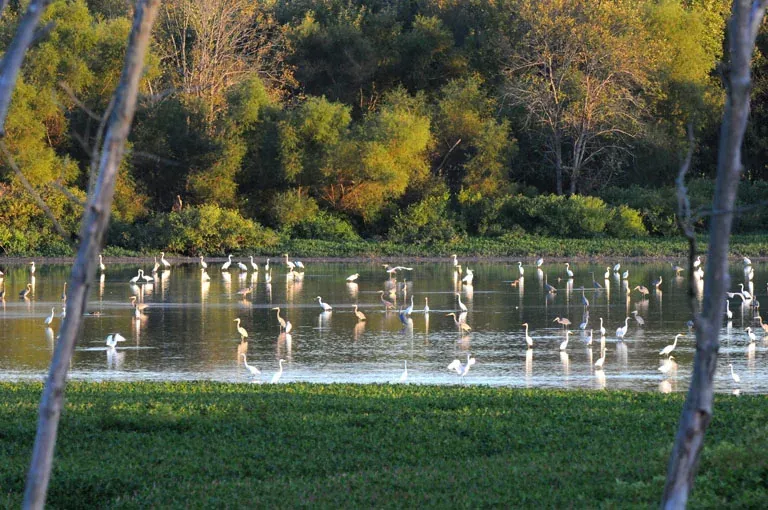
DNR describes the Dewey Point–Wabashiki trail as seven miles and allows cycling on it. Plan a shorter outing if that total is more than your group wants. A viewing stop at Dewey Point can be part of your visit without making the whole trail the goal.
This is an active fish and wildlife area. Check current notices and seasonal entry rules before setting a departure time. Use the property map and do not turn mowed access lanes or a nearby woodland path into an unverified cycling route.
Sources: Indiana DNR: Wabashiki cycling permissions and seasonal access
Settle equipment and meeting points before arrival
Ask the operator about rules for the exact bicycle or equipment you will bring, especially an e-bike, trailer or adaptive cycle. Permission at one destination does not establish permission at another. Check the route's surface and width rather than relying on a broad accessible or family-friendly label.
Save the map and a contact number, agree on a return time, and carry what you need for a small repair. If the route or conditions do not suit the group when you arrive, shorten the outing or choose another day. A picnic or a separate walking stop can give non-riders a useful plan of their own.
Sources & how this guide was prepared
We compare published operator information. Suggested combinations are editorial ideas, not a timed route or an on-site inspection. Operators confirm current access, prices and availability.
- Terre Haute: 2026 Bike & Pedestrian Plan, existing National Road Heritage Trail (page 30) — checked Oct 10, 2026
- Terre Haute: neighborhood parks and recreational trails — checked Oct 10, 2026
- Griffin Bike Park: hours, helmets and route rules — checked Oct 10, 2026
- Vigo County: official Griffin Bike Park map (PDF) — checked Oct 10, 2026
- Griffin Bike Park: official event schedule — checked Oct 10, 2026
- Indiana DNR: Wabashiki cycling permissions and seasonal access — checked Oct 10, 2026
Keep planning your day.
All activity guides

Walks & nature · 6 places
Find a walking trail
Short wetland visits, a 1.5-mile woodland route and larger trail networks.
Hawthorn Park · Prairie Creek Park · Dobbs Park + more
Weekend ideas · 7 places
Plan a day outside
Choose a nature stop, family outing, bike ride or a scheduled heritage program.
Dobbs Park · Collett Park · Fairbanks Park + more
Picnics & gatherings · 3 places
Plan a picnic or gathering
Compare three county shelters by listed seating, nearby play areas and seasonal facilities.
Hawthorn Park · Fowler Park · Prairie Creek Park